
Drimnagh was built in the mid to late thirties to the south west of Dublin, beyond the Grand Canal. Crumlin Road runs to the east of the suburb with the Canal and the Lansdowne Valley and Camac River to the North, West and South.
The area was granted to Hugo De Bernivale, a Norman lord in 1215 who built a castle above the Landsdowe Valley to guard against the O’Toole clan of the Wicklow mountains. Hugo’s descendents, the Barnewalls, remained until the end of the nineteenth century. The Castle, with its unique moat, remains.
This was a rural area of forest and farmland until the great suburban housing projects of the 1930s. First Crumlin, then Drimnagh, Walkinstown and Bluebell. These area were gathered together to form Dublin 12, a largely working class area with a mixture of social and private housing. Drimnagh’s road system is named for Irish mountains. Hence, Mangerton, Brandon, Comeragh, Slieve Bloom and others.
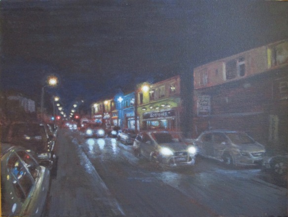
This view is looking north along Errigal Road at evening rush hour in late winter. The row of shops facing date to 1937 and include groceries, off licence, parmacy and a Chinese take away. Behind the shops is Our Lady’s Children’s Hospital, a major project of the fifties. Ahead you can see the traffic lights marking the junction with Brandon Road. Behind the viewer, up till about eighty years ago, would have been Leicester House, the local big house back when Drimnagh was a very different place.
